
· By Sarah Conklin
Lifepoints Adventure Guides: Marin County, CA
Lifepoints Adventure Guides are brought to you by the Picky Bars Crew, Athletes, and extended “Family” because we know that the best way to see a new place is with the help of a local. A quick hit of the favorite trails, secret spots*, and refueling venues that need to be “must-sees” for your visit.
The weekly tour will wrap with a fun spin on our past Adventure Grants where one lucky winner will get to live out one of the city guides in person!
Let's visit Marin County with our Picky Team ultrarunner, Krispy Kreme Challenge winner once upon a time, and beer lover, Alex Varner!
* To protect their identity, we've omitted some our most secret hidden gems.
You'll have to track us down in person for that beta...
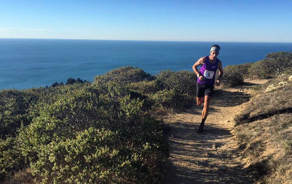
Alex Varner running on the Dipsea Trail near Stinson Beach
MARIN COUNTY, CA
Your Local Tour Guide(s): Alex Varner, Ultrarunner, dad + beer advocate
Marin County sits just across the Golden Gate Bridge to the north of San Francisco. It’s home to several small cities and endless outdoor activities. It claims to be (one of) the birthplaces of mountain biking, but is also home to a huge number of runners, road riders, and all sorts of other athletes. Marin’s main geographic feature is Mt. Tamalpais, which tops out at just around 2,500ft. It’s not a tall mountain by any means, but there are hundreds of miles of trails and open space to explore on foot or two wheels. You have your pick of access points to the outdoors, from Sausalito and Mill Valley in the south to Novato in the north, to Pt. Reyes Station and Olema in the west. Each city has its own feel and offers plenty of opportunities to eat, stay, and play.
SWEAT TIME / ACTIVITIES
RUN/RIDE WITH A VIEW
⭑ Yolanda Trail (Run, 4 miles RT, Strava Activity)
Start and finish at the parking lot at the end of Lagunitas Road in Natalie Coffin Greene Park in Ross, CA. Head up to the dam, keep right around Phoenix Lake, continue up Shaver Grade and take a right onto Hidden Meadow Trail. Take another right onto Yolanda Trail at the first intersection and you’ll be treated to some spectacular views of Mt. Tam from the north. Continue down Yolanda back to Phoenix lake and retrace your steps back to the start. Singletrack mountain biking is forbidden on Mt. Tam so you’ll have to do this one on foot.
Pro tip: Park in Ross Commons (another mile or so down Lagunitas Road) to avoid congestion.
OUT FOR A QUICKIE
⭑Tennessee Valley beach and back (3.5 miles RT, Strava Activity)
Park in the Tennessee Valley parking lot and head down the road to the beach. It’s about 1.7 miles each way on fire road with a nice, gentle downhill on the way out and uphill on the way back. Great views at the beach.
Pro tip: Climb up on the north bluff to get some perspective.
MAKE A DAY OF IT
⭑ Dipsea Trail out to Stinson Beach... and maybe back (7.5 miles one way, Strava Activity)
Start in downtown Mill Valley and follow the Dipsea Trail all the way out to Stinson Beach. The route is hilly (with a lot of stairs in the first mile) but treats you to some great views at the high point (Cardiac Hill). The trip down (and perhaps back up) Steep Ravine is likely to be slippery and treacherous. If you’re super keen for a butt kicking, run a Double Dipsea (out to Stinson and back). If you don’t want to return on foot, bring some cash for the West Marin Stagecoach, which will bring you back to Mill Valley.
Pro tip: Shower down with Tecnu afterwards to avoid poison oak as best you can.
MUST-SEE VIEWS
⭑ Mt. Tam Hill Climb (8-9 miles RT on foot - 3.3 miles up - total length depends on return route, Strava Activity)
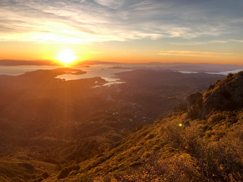
Start in downtown Mill Valley and head up to the top of Mt. Tam for a great view of the surrounding areas. First half of the climb is on roads and mostly runnable but once you hit the trail, be prepared to put your hands on your knees and power hike up some stairs and gullies. Choose your own way down depending on how long you want to run. Nice and gradual descent? Old Railroad Grade. Steep and technical? Fern Creek to Hogback to Tenderfoot.
Pro tip: Don’t forget to touch the door at the lookout.
EATS + DRINKS
FUEL UP FOR A BIG RIDE/RUN
Tons of great pizza options (as well as a few other menu items) to fuel your run/ride the following day.
Pro tip: Pizzas are named after special local trails so perhaps source some inspiration for a route from the names on the menu.
GET A DRINK IN YOUR SPANDEX
A great place to stop for a mid-ride (or run) beer (or two). The inn/pub is straight out of the English countryside and is steps from Muir Beach.
TREAT YO (CALORIE DEPLETED) SELF
⭑ M.H. Bread and Butter, San Anselmo
Founded and run by runners, this bakery/cafe is a great place to recover with pastries, coffee, beer, and great meals. The fried egg sandwich is always a good choice.
Pro tip: Grab a loaf of the sandwich bread to go.
HAPPIEST HOUR
Populated mostly by mountain bikers, but road riders and runners alike are also welcome. Pop your bike up onto one of the wall stands, order a beer from one of the beer selections in Marin and play a board game surrounded by other smelly, dirty endurance folk.
Pro tip: Their food menu is nearly as good as their beer.
images from Gestalt Haus' Facebook
Lifepoints Adventure Guide Archive
-
Bend, Oregon
-
Marin County, CA
-
???
-
???
-
???
-
???

